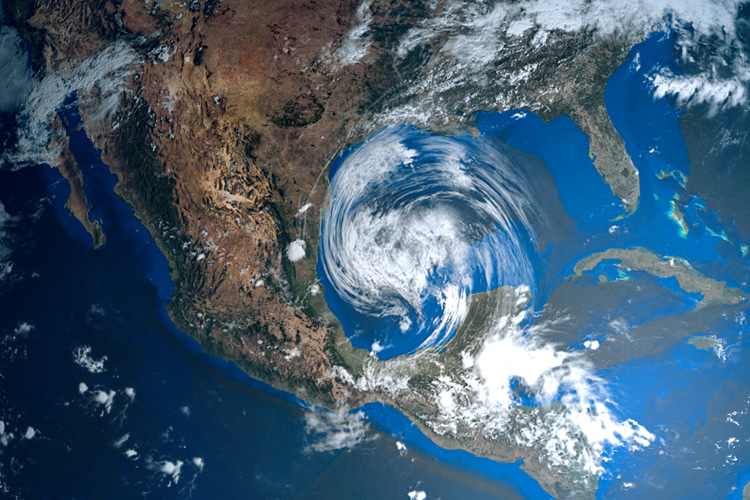
Cyclones, hurricanes, and typhoons are all geographically specific names for strong tropical depressions. Choosing the correct name depends on where they form.
Cyclone is the generic term used in the Indian and Southwest Pacific oceans (west of 160º E).
Hurricane is the Atlantic word, plus it is used for any storm that appears in the Northeast Pacific (east of the International Date Line or 160º E).
Typhoons and Super-Typhoons are reserved for the Northwest Pacific Ocean west of the International Date Line (IDL).
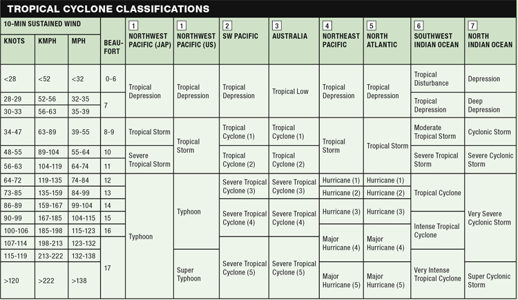
There are also many different scales of measurement for tropical cyclones used by Regional Specialized Meteorological Centres (RSMC).
So, the categories don't always match up, and some measure winds at different heights for various lengths of time, arriving at different averages.
The Saffir–Simpson Hurricane Scale is used for hurricanes only, and the winds must reach 119 km/h (33 m/s, 64 knots, 74 mph) in order for the storm to be officially named a Category 1 hurricane.
However, this is equal to Category 3 on the Australian scale (see table below).
Tropical storms and tropical depressions are further terms used at the lower end of the scale.
The Formation of Tropical Storms
For all cyclones, hurricanes, or typhoons to form, a handful of weather conditions must first combine:
- Surface water temps have to be above 80 ºF (26.5 ºC);
- Atmospheric instability - basically, it is thunderstorm activity that allows the heat stored in the ocean waters to be liberated for the tropical cyclone development through fast cooling and moist convection;
- High humidity and relatively moist layers near the mid-troposphere five kilometers (three miles) up. Moisture is required for the continuing development of widespread thunderstorm activity;
- Enough Coriolis force to get a low-pressure center spinning. That's why cyclones cannot form within 500 kilometers (300 miles) of the equator;
- A pre-existing, near-surface disturbance with sizable spin and low-level inflow. Tropical cyclones cannot be generated spontaneously - they need some kind of spinning weather system to get started;
- Low vertical wind shear refers to the magnitude of wind change between the surface and the upper troposphere. Large values of vertical wind shear disrupt or destroy the tropical cyclone. Low values of less than about 37 km/h (10 m/s, 20 knots, 23 mph) of vertical wind shear are ideal;
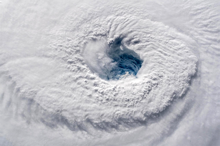
Naming Tropical Storms
Tropical cyclones have been given names since the practice was popularized by US Army Air Corp and Navy meteorologists, who were monitoring tropical cyclones over the Pacific Ocean during World War II.
They chose girlfriends' or wives' names, unlike the Australian forecaster who had dubbed them as political figures whom he disliked years earlier.
In 1945, the armed services publicly adopted a name list of typhoons of the western Pacific, and in 1953, the US Weather Bureau switched to women's names until 1979, when men's names were included.
Other regions followed this pattern until January 2000, whereby tropical cyclones in the Northwest Pacific basin are now given Asian names, including flowers, animals, birds, trees, or even foods, etc., while some are simply descriptive adjectives.
The Australian and South Pacific regions started giving women's names to the storms in 1964 and both men's and women's names in 1974/1975.
The Southwest Indian Ocean tropical cyclones were first named during the 1960/1961 season.
In the North Indian Ocean region, tropical cyclones were slow on the name game and only started in 2006.
Storm names are allocated alphabetically through any one season and traditionally provide surfers with a reference point, giving the storm a personality and allowing a deeper, more memorable interaction with the waves that are produced.
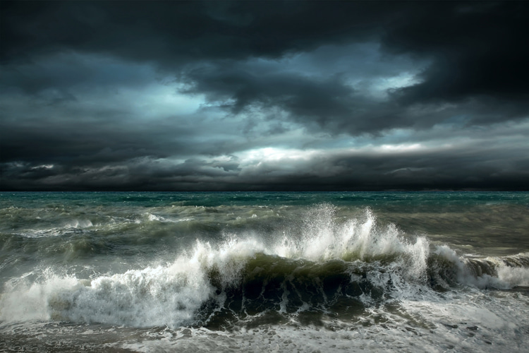
Tracking Tropical Storms
Forecasts for individual storms and their impacts are provided by the National Oceanic and Atmospheric Administration's (NOAA) National Hurricane Center, which continuously monitors the tropics for storm development and tracking throughout the season using an array of tools, including satellites, hurricane hunter aircraft, radars, buoys, and advanced computer modeling.
Two of these high-tech programs include the Hurricane Weather Research and Forecasting (HWRF) and the Geophysical Fluid Dynamics Laboratory (GFDL) models, boasting a vast improvement in forecasting a storm's track and intensity, which should save some lives.
The Regional Specialized Meteorological Centres are strung across the seven major tropical cyclone basins, sited in Florida, Hawaii, Japan, India, Reunion, Australia, and Fiji, plus a handful of regional offices, all working together as part of the World Weather Watch.
From all these agencies, global trends and facts emerge:
- Annual average = 86 tropical cyclones (tropical storm intensity);
- Forty-seven of them reach hurricane/typhoon strength, and 20 become powerful tropical cyclones (Category 3+, severe, intense, super, major);
The major surf forecasting websites often provide cyclone, hurricane, and typhoon tracking tools that are specifically designed to help surfers with the classic question: where, when, and how big?
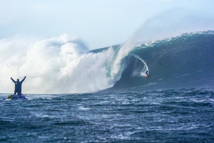
Tropical Storms and Surf Creation
There are a few notable differences between the swell and waves produced by a cyclone, hurricane, or typhoon and the surf produced by a normal (mid-latitude or extra-tropical) low pressure.
They both create waves in exactly the same way by winds blowing across the surface of the ocean, but cyclones are usually much smaller in diameter with far less fetch than a sprawling winter, mid-latitude low that will produce greater wave height.
These fetch-limited tropical storms can move extremely quickly and often change direction suddenly, which doesn't allow enough time for a good swell to spawn from a single direction.
This can translate to really short swell events that decay rapidly over the open ocean, further limited by the small seasonal window in which tropical storms are active.
Conversely, a storm that stalls or travels slowly in a straight line can make the surf pump for days on end and send out swell in many directions.
Other factors to consider are how the bulk of the swell propagates out from the storm in the direction of travel, with the right side of the storm (regardless of the hemisphere) always containing more energy, so the leading quadrant on the right should create more swell.
Examples include strong SE swell for the US East Coast as a hurricane approaches on a direct E to W path towards the Caribbean and ideal NE swell for the East Coast of Australia as a cyclone heads south from New Guinea through the Coral Sea.
Sailors dubbed the right half of the cyclone the dangerous semicircle since the heaviest rain, strongest winds, and biggest seas were located in this half of the storm.
Some storms can wind up, make landfall, lose intensity, and fizzle out or else head back out to sea and re-energize, even combining with the mid-latitude depressions and becoming an extra-tropical cyclone bringing swell to west-facing shores like Europe in the late summer.
Knowing when a storm swell may arrive by calculating speed is fraught with variables, but if you know the swell period or the size of the storm, then a few guesstimations can be made.
Lower-scale storms outputting swell periods of 10-12 seconds will travel about 650 kilometers (400 miles) per 24 hours.
Moderate scale with around a 14-second period should cover 800 kilometers (500 miles), while the big Category 4 and 5 storms will see 16-second-plus period swells march over almost 1,000 kilometers (620 miles) of open ocean if the storm track is heading your way.
Anecdotal evidence suggests there is something about cyclone swells, which ramps up the power and also the number of waves in a set, as typhoon surfers often report sets of 12-15 waves compared to the average of 4-6.
No matter which ocean you are in, there is always a fine line between chasing down some tropical storm swell and getting caught in the storm itself, which brings strong winds, heavy rain, and storm surges to low-lying areas.
Storm surges are responsible for 90 percent of tropical storm deaths.
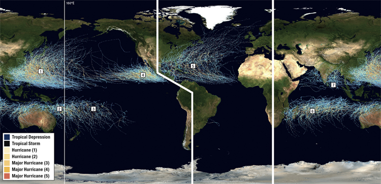
The Magnificent Seven
1. Northwest Pacific (April-January)
This region holds the record for tropical storms, spinning up the biggest, fastest, and highest number of typhoons every year.
Their tracks cover a vast area of ocean, so a lot of countries are in the firing line.
Micronesia, Philippines, Taiwan, China, Japan, and then a second blast for those mid-Pacific islands if the storm throws a curveball and heads back east.
June-September will be the heart of the typhoon season, which extends for ten months, appreciably longer than any other region.
2. Australia & 3. SW Pacific (November-April)
These storms are harder to predict as historical data shows some fairly random tracks, with loops, stalls, and sudden direction changes a common occurrence.
Cyclones can also traverse the top of Australia, effectively linking the Pacific and Indian oceans.
The Solomon's, New Hebrides, New Caledonia, Fiji, Tonga, and Samoa can all take direct hits, but it is really Australia and even New Zealand that benefit the most from the west and south tracking storms while the South Pacific Islands further east are more likely to experience the lower Category 1 and 2 storms.
Whole seasons can pass without anything over Category 3, so there's no banking on a cyclone swell in the temperamental SW Pacific.
4. Northeast Pacific (May-November)
These are the hurricanes that form off the coast of Mexico and Central America, then head in a west-to-north arc, bringing shorter, stronger swell events to these countries, plus longer distance waves to California and the West Coast USA, as well as the southeast exposed shores of Hawaii, thousands of miles away.
Both coasts of North America experience their highest water temperatures in late August or early September, so this usually coincides with prime hurricane time.
5. North Atlantic Hurricanes (June-November)
Forming around disturbances off the coast of West Africa, the storms have a reasonably straight run down Hurricane Alley, a swathe of warm water that leads all the way to the east coast of Central America.
That means there's a lot of good surfing real estate affected on either side of the alley, including all the countries bordering the Caribbean, East Coast USA, the Gulf of Mexico coast, and NE South America.
Don't forget the chance of a hurricane re-energizing as it heads polewards and joining the procession of lows heading west to Europe.
The South Atlantic isn't completely devoid of hurricanes (Catarina, Brazil, Category 2, 2004), but water temps and wind shear are usually against tropical storm formation.
6. Southern Indian (November-April)
Madagascar and the Mascarenes are in the favored path of these cyclones that start off heading west before a short parabola to the south snuffs them out in the cooler waters.
These inconsistent storms, like the other Southern Hemisphere cyclones off both coasts of Australia, are generally less intense, shorter-lived, and harder to track than their Northern Hemisphere cousins.
Few of the bigger systems make landfall on Africa, while Madagascar bears the brunt, and Western Australia is also prone to some Category 3 direct hits to the northwest coast.
7. Northern Indian (April-December)
The Bay of Bengal witnessed the most deadly cyclone ever when Bhola surged ashore in Bangladesh in 1970.
More recently, Nargis killed hundreds of thousands in Myanmar, proving this basin may not be the most active, but it is certainly capable of occasionally producing powerful cyclones.
Waves can result in India, Sri Lanka, Thailand, the Andaman Islands, and Sumatra, but the high season is short and runs from May to June.
Across the sub-continent in the Arabian Sea, there is even less storm activity and little cyclone swell for established surf nations like the Maldives, which sit in the equatorial doldrums and experience too much decay in the swells from both the north and the south.
Words by "The World Stormrider Guide" | Published and Edited by Ollie Fitzjones, Bruce Sutherland, Dan Haylock, and Antony Colas
