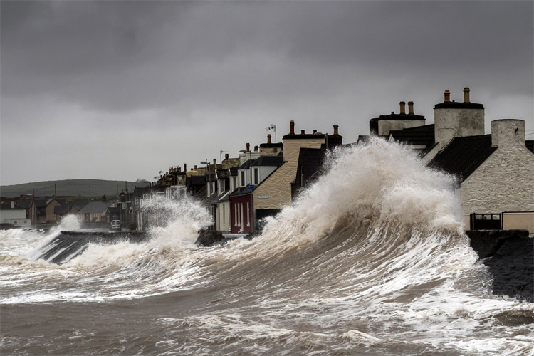
A storm surge refers to the unusual elevation of water levels triggered by a storm that exceeds the expected tidal levels.
It represents the fluctuation in water levels directly attributable to the storm's influence.
Storm surge is a relative measure between water levels, so it doesn't have a specific reference point.
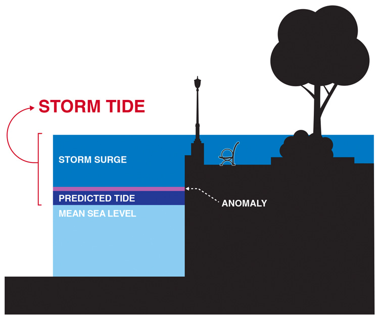
When the storm surge merges with the regular tide, it results in what is known as the storm tide.
To illustrate, a storm surge of 15 feet (4.5 meters) coupled with a high tide standing two feet (0.6 meters) above the average sea level culminates in a storm tide of 17 feet (5.1 meters).
What Triggers a Storm Surge?
The primary driver of a storm surge is the potent winds associated with a hurricane or tropical storm, while the storm's low pressure plays a lesser role.
The wind movement around a hurricane's eye impacts the ocean surface, leading to vertical circulation in the water.
In deeper waters, the storm surge is barely noticeable as there are no obstructions to this circulation.
However, when the hurricane approaches the coast where the waters are shallower, the ocean bottom disrupts the vertical circulation.
With the water unable to descend, it has no choice but to rise and move inland.
When and Where Does It Occur?
A storm surge has the potential to extend far inland from the shoreline.
For instance, during the passage of Hurricane Ike, the surge was observed to travel almost 30 miles (48.2 kilometers) inland in certain areas of southeastern Texas and southwestern Louisiana.
Every region along the U.S. East and Gulf coasts is susceptible to storm surges.
Areas that are prone to flooding from a Category 4 hurricane are especially at risk.
The Role of Waves
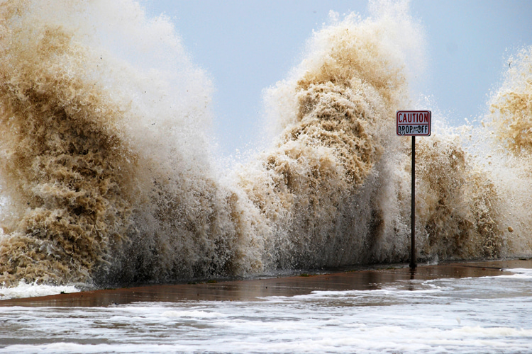
The rise in water level during a storm surge is further amplified by breaking waves through processes known as wave runup and wave setup.
Wave runup is the phenomenon where a breaking wave propels water onto the shore.
Wave setup, on the other hand, is when waves continuously break onshore, causing the water from the runup to accumulate along the coast as it cannot return to the sea.
As a result, the water level increases as a hurricane nears, particularly as the waves grow larger and push more water onshore.
Monitoring and Measuring
There are various techniques to track and measure storm surges, each with its unique set of advantages and disadvantages.
Tide Stations
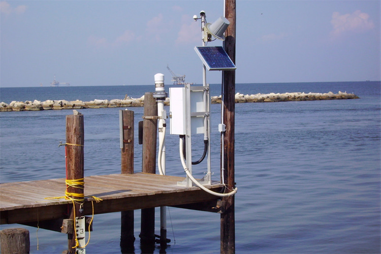
Tide stations are used to monitor changes in water levels along the coast.
The storm surge can be determined by subtracting the expected water level (in the absence of the storm) from the actual measured water level.
National Oceanic and Atmospheric Administration's (NOAA) National Ocean Service (NOS) oversees a network of around 175 tide stations across the United States.
Pros
- They provide real-time data;
- They are traditionally considered the most dependable method for surge measurement;
Cons
- The number of stations along the coast is limited;
- They often malfunction during the peak of an event due to power loss or physical damage;
High Water Marks
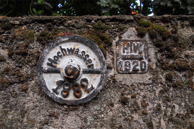
High water marks are indicators on trees and structures that denote the maximum height reached by water during a flood event.
They are formed by foam, seeds, or other floating debris.
After a storm, survey teams are dispatched to identify and document these reliable high water marks, typically using GPS techniques.
Pros
- They are traditionally the optimal method for recording the maximum surge from an event;
Cons
- They do not provide real-time data;
- The interpretation of these marks can be subjective;
Pressure Sensors
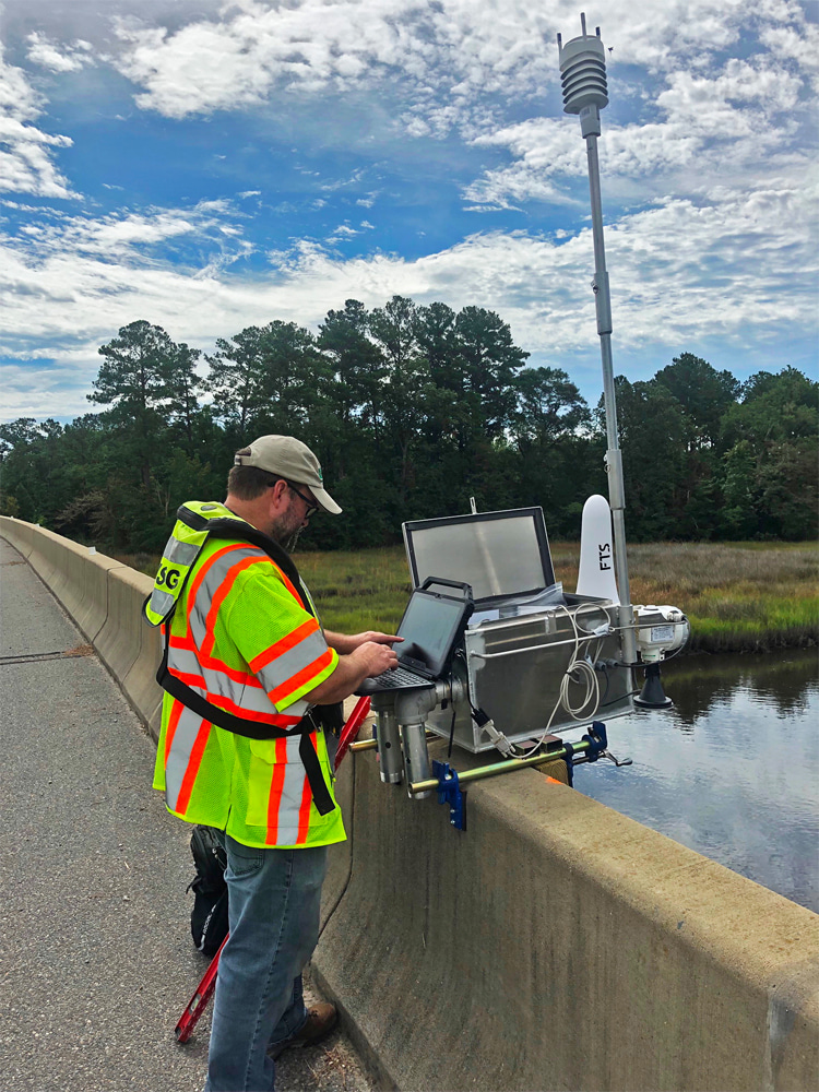
The United States Geological Survey (USGS) uses temporary barometric pressure sensors to gather information about the duration of a storm surge, the times of its arrival and retreat, and its maximum depths.
Pros
- They can provide timing information that high water marks cannot:
Cons
- The data from these sensors is not available in real time;
- It can be challenging to retrieve the instruments after a storm;
Don't Go Surfing
Surfing during a storm surge is generally not recommended due to the numerous safety risks involved. Here are a few reasons why:
- Strong Currents: Storm surges are associated with strong winds and high waves, which can create powerful currents. Even experienced surfers can find it challenging to navigate these conditions;
- Debris: Storms can churn up trash from the ocean floor or wash objects into the sea from the shore. This debris can pose a significant hazard to surfers;
- Rapidly Changing Conditions: The weather conditions during a storm can change rapidly, making it difficult to predict and react to dangers;
- Coastal Erosion: Storm surges can cause significant coastal erosion, altering the underwater topography and creating unpredictable and dangerous conditions for surfers;
- Emergency Services: During severe weather events, emergency services may be stretched thin dealing with other incidents. If a surfer gets into trouble, help may not be readily available;
- Wildlife: Storms can also affect marine life behavior, potentially increasing the risk of encounters with dangerous species;
While the large waves associated with storm surges might seem appealing to thrill-seeking surfers, the risks involved make it a dangerous endeavor.
It's always best to prioritize safety and avoid surfing during these conditions.
Conclusion
Understanding storm surge is crucial for predicting the impact of hurricanes and other major storms.
It's a complex phenomenon influenced by a multitude of factors, including the storm's intensity, size, forward speed, and angle of approach to the coast.
The shape of the coastline, the width and slope of the ocean bottom, and local features also play a significant role.
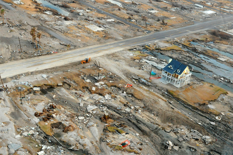
Storm surges can cause catastrophic damage, as seen in events like Hurricane Katrina and Hurricane Ike.
It's not just a coastal issue but can penetrate well inland, causing widespread flooding and destruction.
Observing and measuring storm surges is a challenging task, with various methods offering different advantages and disadvantages.
From tide stations to high water marks and pressure sensors, each method provides valuable data to help us understand and predict this powerful force of nature.
As our climate changes and sea levels rise, understanding storm surges becomes even more critical so that we can better predict and prepare for these events, potentially saving lives and reducing damage.
